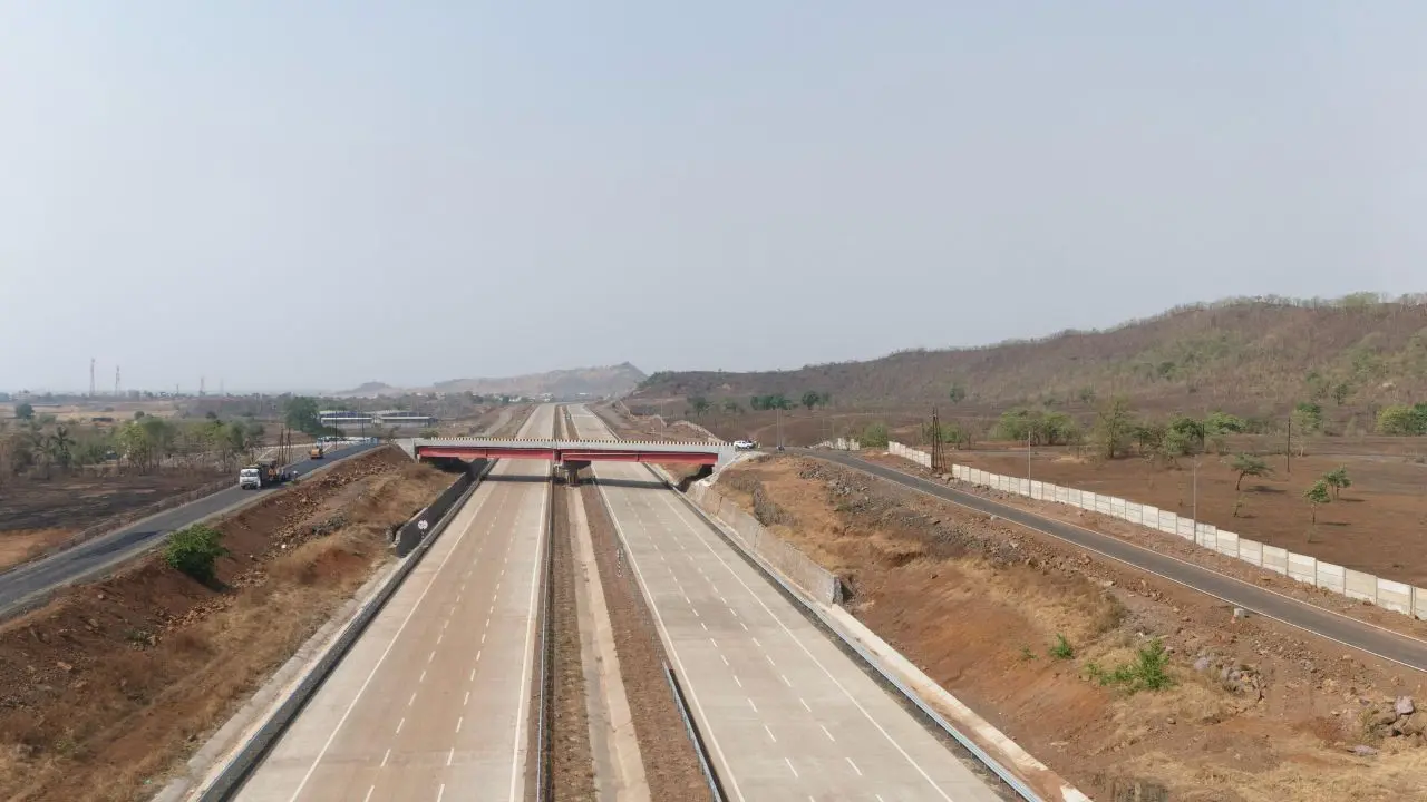
In a major milestone for Maharashtra’s infrastructure, the final 76-kilometre stretch of the Hindu Hriday Samrat Balasaheb Thackeray Maharashtra Samruddhi Mahamarg — connecting Igatpuri to Amane — was inaugurated on Thursday, June 5, by Deputy Chief Minister Devendra Fadnavis.
With this addition, the expressway now spans an impressive 701 kilometres, seamlessly linking Nagpur to Mumbai while connecting 24 districts across Vidarbha, Marathwada, and North Maharashtra. Designed to significantly reduce travel time between eastern and western Maharashtra, the corridor is expected to cut what was once a 16-hour drive down to approximately eight hours.
Technically ambitious and visually striking, the route features five double tunnels, including Maharashtra’s longest — an 8-kilometre stretch at Igatpuri — a feat of modern engineering that helps the expressway traverse some of the region’s most challenging terrain. Alongside improved connectivity, the project also aims to spur economic development in rural areas by facilitating faster logistics, strengthening trade routes, and supporting regional growth corridors.
However, despite its inauguration, the newly opened section has not yet been updated on Google Maps. As a result, several commuters have found themselves confused or unaware of the availability of the final stretch. Officials have confirmed that integration with mapping platforms is in progress and navigation tools will soon reflect the full route.
The Samruddhi Mahamarg is not just a road — it’s a statement of intent. It’s Maharashtra’s vision of speed, efficiency, and equitable development now laid in concrete. As the final stretch opens, the state inches closer to a future where distance no longer defines access.